
Mountain Guides
Bjelasica, Montenegro: Hiking, Lakes & Kolašin Guide
Table of Contents
Bjelasica offers a different rhythm from Montenegro's dramatic limestone mountains. Around Kolašin, broad grassy ridges, forested slopes and mountain pastures create a landscape that invites you to slow down rather than collect summits. It is a rewarding place for a walk with a view, a longer hike with a local guide or a few days exploring the northern highlands. The attraction is not one famous viewpoint: it is the transition from forest and glacial lake to open mountain.
The name Bjelasica refers to a mountain range, not a single resort or a single trail. Kolašin is a practical base, while Biogradska Gora National Park protects part of the range. That distinction matters when planning: the lakeside forest walk, high-altitude pasture routes and ski-area approaches have different access points, seasons and levels of difficulty.
Why choose Bjelasica?
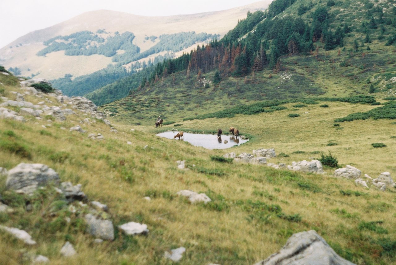
Unlike the sheer rock faces that define some of Montenegro's better-known mountain scenery, Bjelasica is recognised for its rounded, open slopes. That does not make every route easy. A long ascent, exposed ridge, fog or wet grass can turn an apparently gentle landscape into a demanding outing. Choose the walk for your experience and the day's forecast, not for the way it looks in a photograph.
For a first visit, think in three experiences: a gentle forest-and-lake day at Biogradsko Lake, a higher pasture landscape around Vranjak, or a summit-oriented hike towards Zekova Glava and Crna Glava. They are alternatives rather than stops to squeeze into one afternoon.
Biogradska Gora and the lake: the gentler introduction
The national park's best-known starting point is Biogradsko Lake. The Kolašin Tourist Organisation describes a 3.5 km circuit, typically taking one to one and a half hours, and classifies it as easy. The walk is a useful introduction to the forest landscape, especially for visitors who do not want to spend an entire day climbing. Allow additional time for the drive, photographs, weather and any park-entry procedures.
Do not assume that the park gate, road and lakeside facilities are available on every date. The National Parks authority announced a reopening on 16 March 2026, explicitly linked to favourable conditions that year; it was not a promise of year-round access. For autumn, winter and early spring visits, check the National Parks authority before leaving Kolašin.
A lakeside walk and a high-mountain hike should not be treated as interchangeable. Even if the lower trail is accessible, snow or low cloud may make the upper slopes unsuitable.
Three hiking options, from easy to demanding
| Route | Published information | Who it suits |
| Biogradsko Lake circuit | 3.5 km; about 1–1.5 hours; easy | Visitors seeking a short forest walk |
| Biogradsko Lake to Goleš pasture | 4 km ascent; 579 m elevation gain; about 1 hour 40 minutes uphill | Hikers comfortable with a sustained climb |
| Vranjak to Zekova Glava or Crna Glava | 3.7 km / 7 km outward; published ascent times about 1 hour 20 minutes / 2 hours 15 minutes | Prepared walkers seeking open mountain terrain |
These figures come from the Kolašin Tourist Organisation's trail descriptions. They are published route figures, not guaranteed door-to-door times. They do not include getting to the trailhead, rests, navigation delays or the return journey. Verify whether the listed distance refers to one direction before estimating the total day.
### The forest climb to Goleš
The route from Biogradsko Lake to the Goleš summer pasture gains height through the forest. The tourism office lists 579 metres of ascent over 4 km, a useful reminder that short distance does not mean low effort. The traditional pasture landscape gives the walk a different character from the lakeside circuit. Take enough time for the descent, which can be slower on slippery ground.
### The open slopes around Vranjak
Vranjak is associated with the traditional *katun* — a seasonal mountain settlement and pasture. The official route towards Zekova Glava and Crna Glava passes through broad grassy terrain and along tracks that may be exposed to wind. Crna Glava, at 2,139 m, is the range's highest summit. Treat these as mountain outings: carry an offline route, layers, food and water, and turn back if visibility deteriorates. A locally qualified guide is a sensible choice for unfamiliar high routes.
### A viewpoint without a summit race
You do not need to reach the highest point to appreciate Bjelasica. On a suitable-weather day, a shorter walk through pastureland can reveal the contrast between open ridges, distant peaks and the forested valleys below. Stay on established paths and respect grazing animals, gates and private or working land.
A realistic one-day plan from Kolašin
Easy day: start from Kolašin, check the national park's current access, then visit Biogradsko Lake and walk its circuit. Keep the rest of the day flexible for lunch, an unhurried return and a short stop in town. This is a better plan for mixed-ability groups than combining the lake with a summit.
Hiking day: arrange transport to a confirmed mountain trailhead, select one route based on weather and ability, and allow a generous return margin before dark. A high pasture or summit route should be the main activity, not an addition after several other stops.
Two days: give the forest-and-lake environment its own day and reserve the second for an open-mountain walk. This is a more rewarding contrast than rushing between access roads. Bad weather can be a reason to switch days or replace the mountain outing with time in Kolašin.
How to reach the area
Kolašin is the most straightforward base for travellers arriving from central Montenegro or continuing north. Biogradsko Lake lies on a different approach from the higher Bjelasica trailheads; the tourist office places the lake roughly 22 km from Kolašin. Do not navigate simply to “Bjelasica” and assume that the map pin is your trailhead.
An independent car offers flexibility, but access roads can be narrow, steep, unpaved or seasonally affected. Confirm the exact meeting point and whether your vehicle is suitable. Public transport may get you to Kolašin, but it does not automatically solve the last stretch to every mountain route. Ask your accommodation or guide about a verified transfer rather than relying on a speculative timetable.
If your journey includes several regions, compare the pacing in our Montenegro road-trip guide instead of treating every northern destination as a short detour.
When to visit: green season, autumn and snow
Late spring and summer are often appealing for open pastures and walking, but higher routes may retain snow after lower paths are clear. Early autumn can bring quieter days and striking colours; daylight shortens and rain or fog can change conditions quickly. Winter transforms access and activities: a ski-area visit, snowshoe outing or mountain walk depends on current operating information, avalanche and weather conditions, and suitable equipment.
The Kolašin Tourist Organisation presents the destination as suitable for both summer hiking and winter sports, but that is not a statement that a particular lift, piste or trail is open today. For a broader seasonal comparison, read our Montenegro winter guide.
Safety, park rules and responsible travel
Mountain weather can change faster than the weather in Kolašin. Check a mountain-specific forecast, not only a city temperature. Carry water, weatherproof layers, sturdy shoes, a charged phone and an offline map. Tell someone where you are going. If the route is remote or the forecast uncertain, choose a guided outing.
Within the national park, follow posted restrictions, keep to authorised routes and do not remove plants or disturb wildlife. Take litter back with you. Pasture huts and working farms are not automatically visitor attractions; ask before entering or photographing people closely. Never count on finding an open café, water refill or mobile signal at a high trailhead.
FAQ
Is Bjelasica the same as Biogradska Gora? No. Bjelasica is the wider mountain range; Biogradska Gora is a national park protecting part of it.
Can I see Bjelasica without a difficult hike? Yes. When access is open, the 3.5 km circuit around Biogradsko Lake is an easier introduction. High ridges are a separate undertaking.
Is a car necessary? It helps reach different trailheads, but you can also arrange transport or a guided walk from Kolašin. Check the last-mile connection in advance.
Can I hike there in November? Possibly on suitable lower routes, but conditions are variable and high ground may be unsafe. Check access, daylight and the forecast locally.
Can I visit the lake and Crna Glava in one day? That is an ambitious combination involving different access points. For most visitors, choose one main route or divide the experiences over two days.
Sources and photograph
Route descriptions: Kolašin Tourist Organisation — hiking trails, Biogradsko Lake circuit, Vranjak to Crna Glava. Park access and regulations: National Parks of Montenegro. Verify all conditions for your actual travel date.
Photograph: Vuk Pajković, “Bjelasica šiška blatina”, photographed 29 July 2011; CC BY-SA 4.0. The original photograph is displayed with a cover crop; attribution and the same licence apply to the cropped presentation.